ทริปนี้เราอยากเห็นทะเลอันดามัน เลยขับรถมาถึงระนอง ซึ่งเราไม่เคยมาที่นี่เลย ครั้งนี้เป็นครั้งแรก แต่ก็ได้เห็นวิถีชีวิตคนระนองไปด้วย
This trip I want to see the Andaman sea so driving to Ranong province Thailand and I haven't been came here before this first time for me, here I'm see the life style of Ranong peoples.


เส้นทางระหว่างชุมพรมาระนองกำลังก่อสร้าง มืดด้วย ทำให้ต้องค่อยๆขับรถ อย่างระมัดระวัง เพราะเราไม่เคยมา ทำให้เรามาถึงก็ดึกมากละ เกือบเที่ยงคืน ขับรถหาที่พัก จนมาเจอที่นี่ Home Sweet Home แต่ไม่มีใครอยู่ ต้องรอค่ะ ง่วง ห้องสะอาดมาก ข้างในเครื่องใช้ก็ครบครัน แอร์ 450 บาท/คืน ประทับใจที่พัก
The route between Chumphon province came to Ranong province have a construction and dark, just be careful too much and made me came to here is very late, almost midnight, drive to look about the hotel until found the Home Sweet Home Resort but nobody now, I sleepy and waiting them.


จังหวัดระนอง เป็นจังหวัดชายฝั่งทะเลตะวันตกของภาคใต้ มีพื้นที่ประมาณ 2,141,250 ไร่ มีพื้นที่ติดต่อทางตะวันออกติดต่อกับจังหวัดชุมพร ทางใต้ติดกับจังหวัดสุราษฎร์ธานี และ จังหวัดพังงา ทางตะวันตกติดกับประเทศพม่า และ ทะเลอันดามัน มีลักษณะพื้นที่เรียว และ แคบ มีความยาวถึง 169 กิโลเมตร และมีความแคบในบริเวณอำเภอกระบุรี เพียง 9 กิโลเมตร คำว่าระนองเพี้ยนมาจากคำว่า แร่นอง เนื่องจากในพื้นที่จังหวัดมีแร่อยู่มากมาย / ระนอง
Ranong province is the West Coast of the South of Thailand. The area of 2,141,250 Rais (hectares). The east is adjacent with the Chum Phorn province. The southern is adjacent to Surat Thani province and Phang Nga province. The western is adjacent to Burma and the Andaman Sea. The area of taper and narrow with a length of 169 kilometers. The most of a narrow area is at Kra Buri district in Ranong, just 9 kilometers. The word "Ranong" was distortion of the word "Raenong", because a rich the minerals in the area of the province. (In Thai : Rea แร่ is the mineral, Nong นอง is a rich).


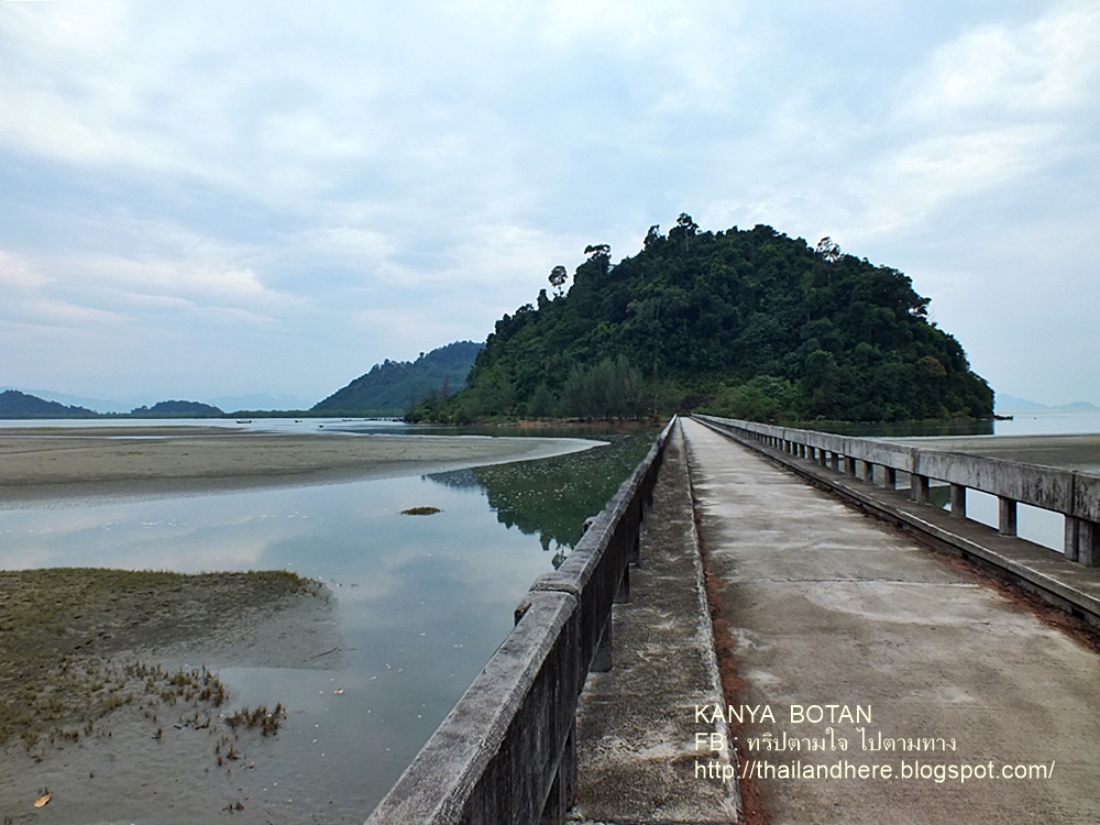
ท่าเทียบเรือศุลกากรระนอง และ อาคารประภาคารเฉลิมพระเกียรติ 80 พรรษา ที่สูงที่สุดในประเทศไทย เพื่อร่วมเทิดพระเกียรติพระบาทสมเด็จพระเจ้าอยู่หัว เนื่องในโอกาสที่ทรงเจริญพระชนมพรรษาครบ 80 พรรษา ในวันที่ 5 ธันวาคม 2550 ตั้งอยู่ที่ริมฝั่งแม่น้ำกระบุรี บ้านเขานางหงส์ ต.ปากน้ำ อ.เมืองระนอง จ.ระนอง เป็นอาคาร 8 เหลี่ยม ก่อสร้างปี พ.ศ. 2545 ใช้งบก่อสร้าง 85 ล้านบาท ตัวสะพานยาว 344 เมตร กว้าง 10 เมตร ทางเดินเท้ามีหลังคา กว้าง 2 เมตร ประภาคารความสูง 48.5 เมตร สูง 9 ชั้น ด้านบนสุดของประภาคาร จุคนได้ประมาณ 50 คน เป็นจุดชมวิวสามารถมองเห็นทิวทัศน์ 360 องศา ของทะเลอันดามัน แม่น้ำกระบุรี และ จังหวัดเกาะสอง ของประเทศพม่า / MGR Online 24/12/2550
Ranong Customs Pier and The King's 80th Birthday Anniversary Lighthouse the tallest of Thailand. For celebrate on the occasion of His Majesty King Rama 9's 80th Birthday Anniversary on December 5, 2007. It is located at the Kra Buri River front, in Ban Khao Nang Hong, Pak Nam, Mueang district, Ranong province Thailand. It is an eight-sided, the building construction in year 2002 with a budget of construction spending 85 million baht. A bridge 344 meters long, 10 meters wide and 2 meters wide for footpath, roof. The lighthouse is height 48.5 meter and high 9 floor on top of the lighthouse can capacity of about 50 persons. A scenic 360-degree views of the Andaman Sea, Kra Buri River and Koh Song island provinces of Burma.


มาถึงป้าย อุทยานแห่งชาติแหลมสน แต่เราไม่เข้าไป ลองเลี้ยวซ้ายไปตามถนน ซึ่งบังเอิญมากที่เราไปเจอที่แห่งนี้ สวยมาก เป็นทะเลอันดามัน
I came to the sign of Laem Son National Park but I not enter, just a turn left and following the road. Incidentally can found this place, it is a beautiful the Andaman Sea.


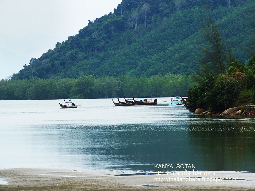


อุทยานแห่งชาติหมู่เกาะระนอง ตั้งอยู่ในท้องที่ต.เกาะพยาม ต.หงาว ต.ราชกรูด และต.ปากน้ำ อ. เมืองระนอง จ. ระนอง มีหาดยื่นออกไปในทะเล และ ปกคลุมไปด้วยป่าชายเลน ซึ่งเป็นป่าชายเลนผืนใหญ่ที่มีความอุดมสมบูรณ์ มีความหลากหลายทางชีวภาพสูง ปี พ.ศ. 2540 รัฐบาลไทยจึงได้จัดทำโครงการร่วมกับประเทศสมาชิกยูเนสโก้ ประกาศพื้นที่ชายฝั่งบริเวณนี้เป็นเขตสงวนชีวมลฑล โลก (International Coastal and Marine Biosphere Reserve) ซึ่งเป็นแห่งที่ 4 ของประเทศไทย พื้นที่ทั้งหมดของเขตสงวนชีวมลฑลโลก มีพื้นที่ประมาณ 214.35 ตร.กม ซึ่งมีพื้นที่ส่วนหนึ่งทับอยู่ในเขตอุทยานแห่งชาติหมู่เกาะระนอง ประมาณ 176 ตร.กม
Mu Ko Ranong National Park is located in the area of Koh Payam , Ngaw, Ratcha Krud and Pak Nam in Mueang district, Ranong province Thailand. Beach extended into the sea and covered with the plenty of large mangroves which the high biodiversity. In the year 1997 Thailand government has established a joint project with UNESCO member countries has declared International Coastal and Marine Biosphere Reserve. Which is the fourth of Thailand. Total an area of 214.35 square kilometers which area is partly covered in Mu Ko Ranong National Park about 176 square kilometers.


อุทยานแห่งชาติหมู่เกาะระนอง เดิมชื่อ อุทยานแห่งชาติหมู่เกาะพยาม โดยกรมอุทยานแห่งชาติ สัตว์ป่าและพันธุ์พืช ได้มีประกาศเปลี่ยนชื่ออุทยานแห่งชาติเมื่อวันที่ 23 กุมภาพันธ์ 2553 ขนาดพื้นที่ 222938.00 ไร่ / สำนักอุทยานแห่งชาติ หมู่เกาะระนอง
Mu Ko Ranong National Park in original name was Mu Ko Phayam National Park by The National Park Service Wildlife and Plants has announced changed a name on February 23, 2010. Area size 222,938.00 Rais (hectares).


ขอบคุณสำหรับการเยี่ยมชม และติดตามเราได้ที่
Thank You and Followed me on


ไม่มีความคิดเห็น:
แสดงความคิดเห็น
หมายเหตุ: มีเพียงสมาชิกของบล็อกนี้เท่านั้นที่สามารถแสดงความคิดเห็น